
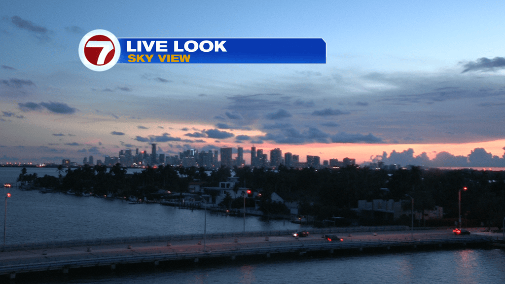
Many of you would probably like to keep the current conditions, but the weather pattern will soon take a turn. Here’s a view of the Miami skyline just past sunset (Monday).
While there was some high cloudiness over us, clouds weren’t rain producers. The closest rain was limited to the Everglades and SW Florida (and not too meaningful).
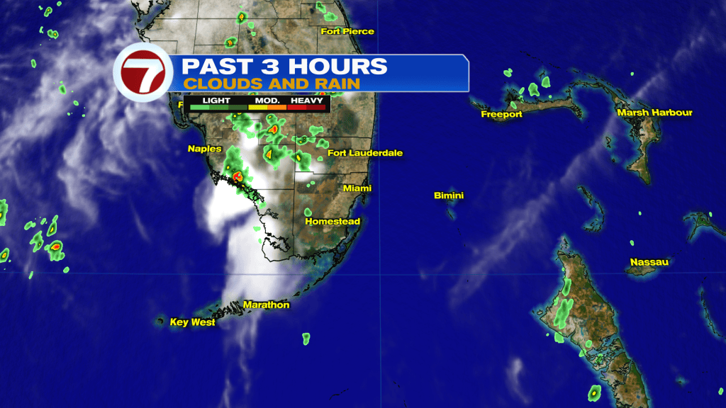
We’ll soon revert back to extra-wet weather, though. There are actually several reasons for rain and features aren’t very far away.
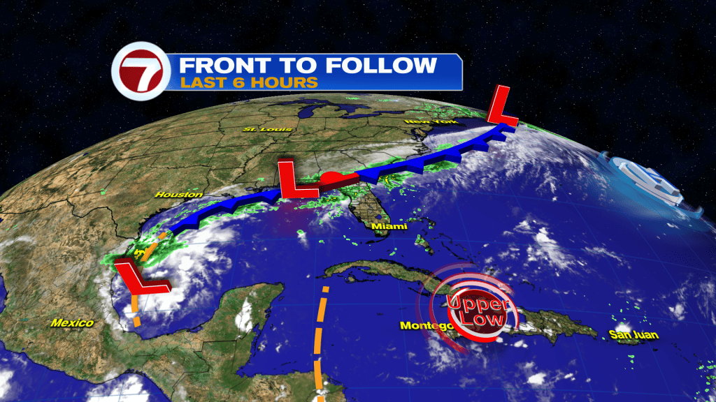
The main focus for south Florida will be on the lengthy Front sitting to our north. It’s a slow-moving boundary that has some real “holding power” with plenty of moisture!
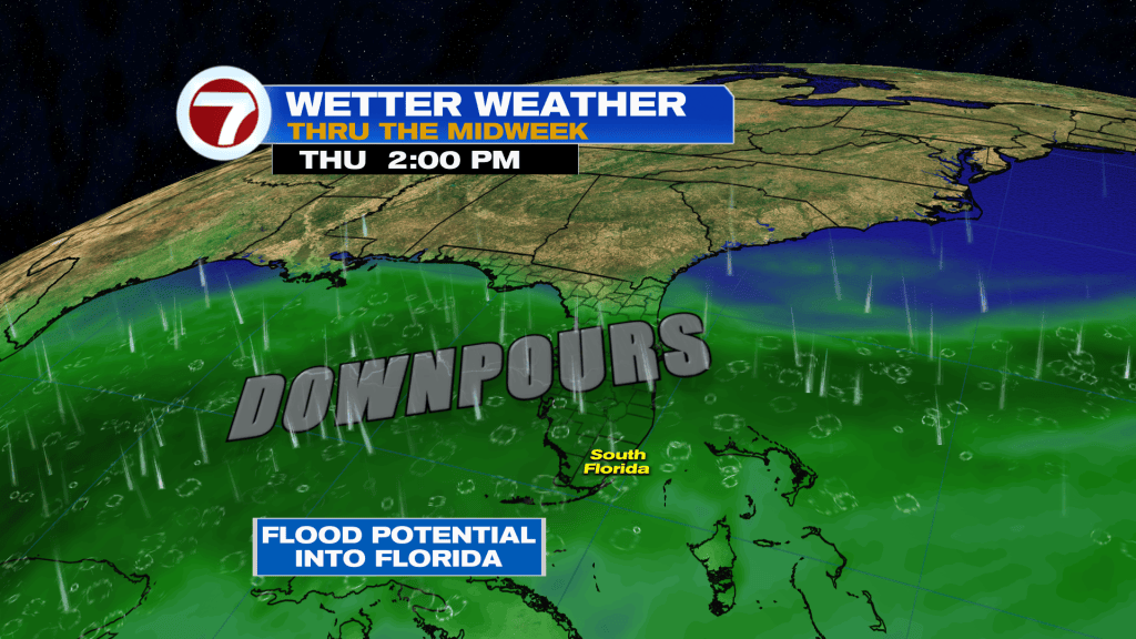
The area in green represents juicy air capable of big downpours and possible flooding rains. The abundance of moisture is expected to hang around for the remaining days this week, but it’s not the only factor for unsettled weather. Rain and storms need the combination of 3 things: moisture, lift, and instability. So, what could trigger the moisture stream into storms? The future position of the aforementioned Front. If it moves closer to Lake Okeechobee prior to stalling, we’ll be near the wettest corridor. However, if it stalls across north-central Florida, the wettest effects should be just out of reach.
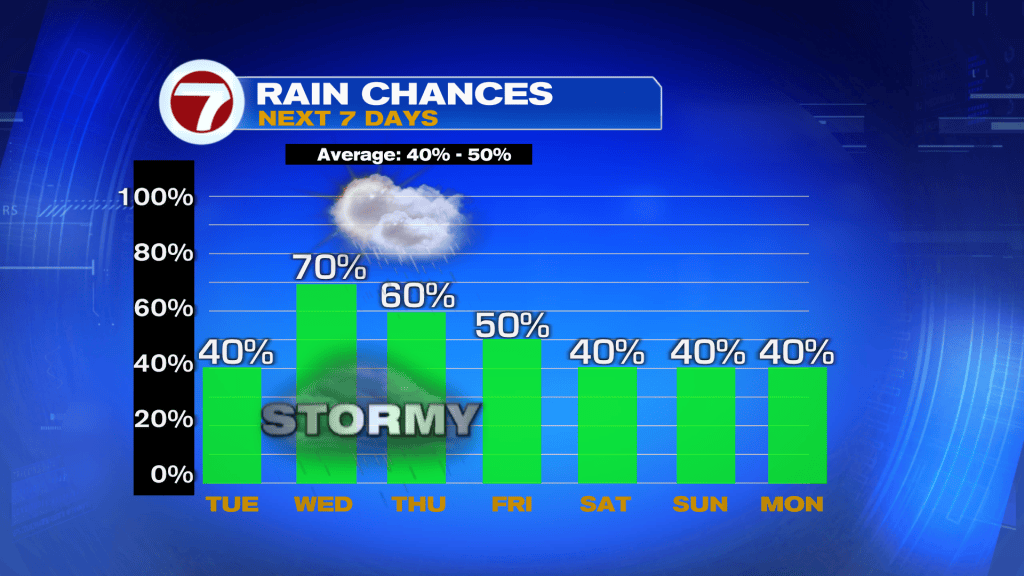
On the latest rain trend (above) you can see the “ramp” to more rain into Wednesday. As for Tuesday, there will simply be some scattered activity that favors the second half of the day. Any developing rain and thunderstorms would be slow-moving with light winds.
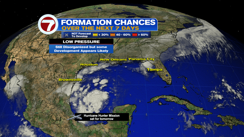
Lastly, there’s something of interest in the tropics. Low Pressure has formed over the western Gulf waters and the National Hurricane Center has it with high odds of developing into a Tropical Depression or Storm. That could come on Tuesday or Wednesday (if it happens fast) and a Recon Mission is tentatively scheduled for a closer look. Until something actually forms it’s tricky to get a clear picture as to where it might go. For the time being, models suggest a northward drift is most likely. Stay tuned.


